
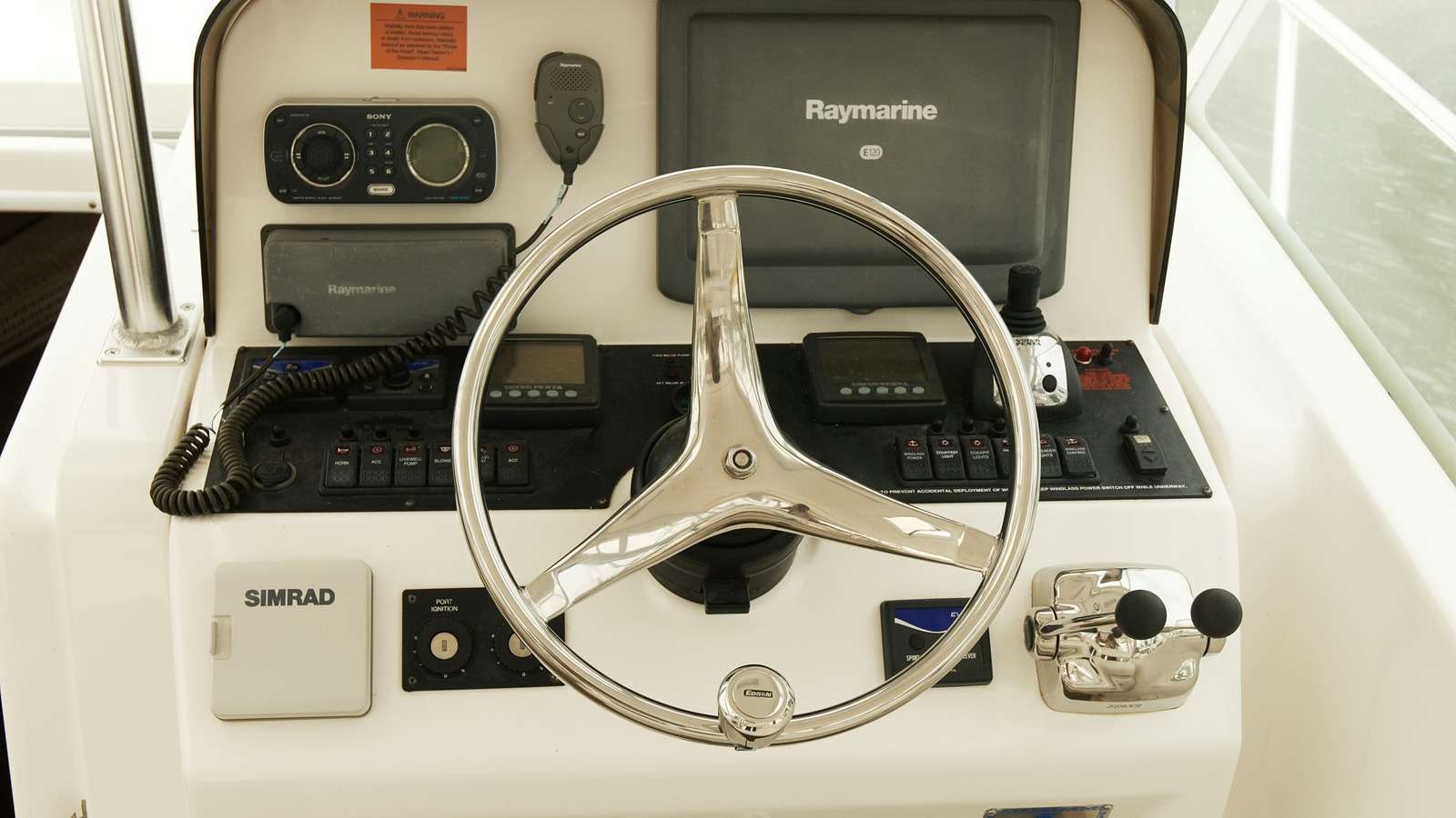
Marine electronics can feel like alphabet soup. GPS, MFD, AIS, DSC, EPIRB, PLB and NMEA 2000 all appear in boat listings and forum discussions, but the names do not always explain what the equipment actually does.
The easiest way to understand a modern helm is to divide the equipment into five jobs: navigation, steering assistance, underwater information, communication and emergency signaling.
GPS and GNSS receivers
GPS is the United States satellite navigation system. A receiver calculates position and time from signals transmitted by multiple satellites. Many modern marine receivers can also use other global navigation satellite systems, which is why the broader term GNSS sometimes appears in equipment specifications.
GPS provides position data. It does not contain the chart by itself, and it does not know whether a route is safe. The receiver's position is normally displayed on a chartplotter or multifunction display.
Chartplotters and multifunction displays
A chartplotter combines position data with electronic charts. It can show the boat's location, course, speed, waypoints, routes, navigation aids, charted depths and hazards contained in the chart database.
A multifunction display, often called an MFD, can place several systems on one screen. Depending on the installation, that may include charts, radar, sonar, AIS targets, engine data, cameras and digital switching.
Electronic charts are a navigation aid, not a substitute for judgment. Charts must be current, and the operator still needs to account for tides, weather, local knowledge, uncharted hazards and the limitations of the equipment.
Electronic compasses and heading sensors
A GPS receiver can calculate course over ground while the boat is moving, but an autopilot, radar overlay and other systems also benefit from accurate heading information.
Electronic heading sensors may use fluxgate technology or modern solid-state sensors. They send heading data to compatible displays, radar and autopilot systems. Proper installation and calibration matter because nearby metal, wiring and electrical equipment can affect compass accuracy.
Autopilots
An autopilot helps steer the boat by combining a control computer, heading sensor and mechanical or hydraulic drive unit. Depending on the system, it may hold a compass heading, follow a route sent by a chartplotter or steer relative to wind information on a sailboat.
Autopilot does not mean unattended operation. Someone still needs to keep a proper lookout, monitor traffic, watch the water and be ready to take control immediately.
Depth sounders, sonar and fishfinders
A depth sounder uses a transducer to send acoustic energy into the water. The system measures the return time of echoes reflected by the bottom and other targets, then estimates depth.
Fishfinders use the same general principle but present more detail about returns in the water column. Modern systems may offer traditional sonar, CHIRP, down-looking imaging, side-looking imaging and other views.
Forward-looking sonar is designed to provide information ahead of the boat, but its useful range and clarity vary with depth, speed, bottom conditions, transducer placement and the specific system.
Marine radar
Radar sends radio-frequency energy and measures echoes returning from solid objects. It can help reveal shorelines, vessels, markers and weather that may be difficult or impossible to see clearly at night, in haze or in rain.
Radar provides range and bearing information, but it requires interpretation. Sea clutter, rain clutter, small targets, blind sectors and incorrect settings can hide or distort returns. Practice in good visibility is one of the best ways to learn what the screen is showing.
AIS
The Automatic Identification System uses marine VHF frequencies to exchange navigation information. Depending on the equipment and vessel, AIS data can include identity, position, course, speed and other voyage information.
An AIS receiver lets you see compatible transmitting vessels on a display. An AIS transceiver also broadcasts your own information. Class A and Class B units differ in reporting behavior, power and carriage requirements.
AIS is useful for awareness, but it is not a replacement for radar or a visual lookout. Not every boat carries AIS, and equipment can be switched off, misconfigured or transmitting inaccurate data.
VHF radio, DSC and MMSI numbers
A fixed-mount VHF radio is still one of the most important pieces of marine safety equipment aboard a coastal boat. It allows communication with the Coast Guard, bridge tenders, marinas and nearby vessels within radio range.
Digital Selective Calling, or DSC, adds digital distress and calling functions. A properly configured DSC radio uses a nine-digit Maritime Mobile Service Identity, or MMSI, to identify the vessel. When connected to position data, a distress alert can include the boat's identity and location.
VHF channel 70 is reserved for DSC. After transmitting a distress alert, boaters should follow the radio's instructions and communicate voice details on channel 16 when possible.
EPIRBs and PLBs
An Emergency Position-Indicating Radio Beacon is designed for marine emergencies. A 406 MHz EPIRB sends a distress alert through the international Cospas-Sarsat satellite system, helping rescue authorities identify the registered beacon and locate the emergency.
Category I EPIRBs are designed to release and activate automatically if a vessel sinks. Other models require manual release or activation. Features vary, so owners should understand the mounting bracket, activation method, battery expiration date and test procedure for their specific beacon.
A Personal Locator Beacon is smaller and intended to be carried by an individual. PLBs are manually activated. They can be valuable on boats, but they do not replace every vessel-specific feature of an EPIRB.
In the United States, 406 MHz distress beacons should be registered with NOAA and the registration should be updated when ownership, vessel information or emergency contacts change.
Satellite communicators and satellite phones
Satellite phones and messaging devices can extend communication beyond cellular and normal VHF range. Capabilities vary from voice and data service to two-way text messaging and subscription-based SOS functions.
They are useful additions for offshore travel, but a consumer satellite communicator should not automatically be treated as a direct replacement for a properly registered marine EPIRB.
Single-sideband radio
Marine single-sideband radio, usually called SSB, supports long-range voice communication beyond normal VHF coverage. An installation requires the transceiver, a suitable antenna system, tuner, grounding or counterpoise arrangements and adequate electrical power.
Licensing and operator requirements depend on the equipment, voyage and country of operation. U.S. boaters should confirm current FCC requirements, especially when traveling internationally or using equipment beyond ordinary domestic VHF, radar and EPIRB operation.
NMEA 2000 and connected electronics
NMEA 2000 is a marine data-network standard that allows compatible equipment to share information over a common network. A chartplotter might receive heading, depth, engine, fuel, AIS, wind and autopilot data through the same properly designed backbone.
Networking does not guarantee that every feature from every manufacturer will work together. Product certification, software compatibility, correct cabling, termination and power distribution all matter.
Power and installation matter
Even excellent electronics perform poorly when installed badly. Voltage drop, weak batteries, poor grounds, corroded connectors, undersized wiring, badly placed antennas and incorrect transducer locations can create problems that look like equipment failures.
A serious electronics installation should include a power plan, proper overcurrent protection, documented network layout, accessible connections and enough battery capacity for the equipment and intended time away from shore power or engine charging.
What should a recreational boater buy first?
Priorities depend on where and how the boat is used, but a practical coastal starting point is:
- A reliable VHF radio with DSC, registered MMSI and position input
- A current chartplotter or navigation display
- A depth sounder appropriate for the boat and water
- An EPIRB or PLB matched to the distance traveled offshore
- Radar and AIS when operating at night, offshore or around heavy traffic
- An autopilot when the boat, route and operating style justify it
The most expensive helm is not automatically the safest. Equipment needs to be understood, maintained and practiced with before an emergency or a night approach makes it essential.
Official resources and further reading
- GPS.gov overview of the Global Positioning System
- U.S. Coast Guard radio information for boaters
- U.S. Coast Guard AIS frequently asked questions
- U.S. Coast Guard EPIRB information
- NOAA SARSAT beacon questions and answers
- National Marine Electronics Association NMEA 2000 overview
- FCC ship radio station licensing information
Featured photo by stephan hinni on Unsplash .
Written by Wiley for ReelBoating.com